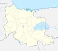
File:Venezuela Carabobo location map.svg
Appearance

Size of this PNG preview of this SVG file: 512 × 386 pixels. Other resolutions: 319 × 240 pixels | 637 × 480 pixels | 1,019 × 768 pixels | 1,280 × 965 pixels | 2,560 × 1,930 pixels.
Original file (SVG file, nominally 512 × 386 pixels, file size: 1.4 MB)
File history
Click on a date/time to view the file as it appeared at that time.
| Date/Time | Thumbnail | Dimensions | User | Comment | |
|---|---|---|---|---|---|
| current | 15:47, 24 July 2023 |  | 512 × 386 (1.4 MB) | Wguayana | Cambio de color |
| 15:23, 24 July 2023 |  | 512 × 386 (1.4 MB) | Wguayana | OpenStreetMap 2023 data | |
| 04:05, 15 August 2017 |  | 627 × 558 (374 KB) | Milenioscuro | capas | |
| 11:01, 19 August 2015 |  | 627 × 558 (367 KB) | Milenioscuro | User created page with UploadWizard |
File usage
No pages on the English Wikipedia use this file (pages on other projects are not listed).
Global file usage
The following other wikis use this file:
- Usage on de.wikipedia.org
- Usage on eo.wikipedia.org
- Usage on es.wikipedia.org
- Los Guayos
- Valencia (Venezuela)
- Lago de Valencia
- Puerto Cabello
- Batalla de Carabobo (1821)
- Guacara
- Canoabo
- Refinería El Palito
- Naguanagua
- San Diego (Carabobo)
- Morón (Venezuela)
- Tocuyito
- San Joaquín (Carabobo)
- Isla Larga (Carabobo)
- Mariara
- Güigüe
- Belén (Venezuela)
- Miranda (Carabobo)
- Montalbán (Carabobo)
- Bejuma
- Borburata
- Wikiproyecto:Ilustración/Taller de Cartografía/Realizaciones/América del Sur
- Isla del Rey (Venezuela)
- Isla del Burro
- Isla Santo Domingo (Venezuela)
- Isla Otama
- Embalse de Guataparo
- Plantilla:Mapa de localización de Carabobo
- Sitio de Puerto Cabello (1822)
- El Cambur ; El Castaño
- Isla Alcatraz (Venezuela)
- Laguna Yapascua
- Isla Chambergo
- Usage on mn.wikipedia.org
View more global usage of this file.


